The Rappahannock River to Washington, D.C.
The morning of Friday, June 25th, the Captain changed the oil in the generator. At 12:30 p.m., we pulled away from the Yankee Point Sailing Marina on Corrotoman Creek, headed down the Rappahannock River and back out in to Chesapeake Bay. We had a nice ride for the most part (best we’ve had in the Bay thus far) with a pleasant northeast breeze and a mid-afternoon temperature of 80 degrees – a 22-degree difference from the previous day! We were anchored by 5:00 p.m. in Cranes Creek on the Great Wicomico River where we enjoyed a beautiful almost-full moon on a calm evening. And we even got a good hold on the anchor!
This is a menhaden boat. Menhaden are small fish that are used as filler in things like cat food and fertilizer. This boat has a smaller boat on its stern that it deploys to retrieve nets full of fish.

Saturday we were off by 9:30 a.m. It was rough in the Bay with rollers on the beam and stern quarter. “Life’s2Short” was bobbing around like a cork in the ocean! We rounded Smith Point and entered the Potomac after a couple of hours and then headed in closer to shore on the port (Virginia) side where we found a much smoother ride. As some of you may know, the Potomac runs between Virginia and Maryland. However, it is interesting to note that the state boundary is not the middle of the river, as it is for many states that have rivers as boundaries. The official boundary is the high-water line on the Virginia shore. Thus, except for the tributaries on the Virginia side, the entire Potomac is in Maryland.
The marker at Smith Point is hard to miss!

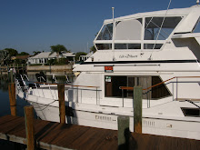
Two-and-a-half hours later we were tied up at Olverson’s Lodge Creek Marina in the South Yeocomico River with highs back in the 90’s. Norm & Vicki on “Tide Hiker” arrived short time later and Vicki and I made a quick trip to nearby Callao, Virginia, in one of the marina’s courtesy cars for a few provisions. That evening “C” dock sponsored a barbecue for everyone at the marina. As you can see by the photos, the cookout had a “redneck” theme.


Fred Olverson, the marina’s owner, with Norm off “Tide Hiker.”

Great to see you again, Norm & Vicki!

Norm & Vicki left Sunday morning and we spent a quiet day on the boat luxuriating in the air conditioning. Fred wanted us to move from “D” dock to the space “Tide Hiker” had vacated on “A” dock, which put us very close to the laundry room, so I managed to get in a couple of loads of laundry and defrost the refrigerator.
We pulled over to pump out the holding tanks late Monday morning and were on our way out of the marina at noon. The wind was predicted to be 5-10 mph but was a good 15-20+ on the bow. A rough four hours later we pulled in to Shymansky’s Marina at Cobb Island, Maryland. It was another hot, muggy, 100-degree day so we signed up for another night of air conditioning.
The Captain fed bread to this assortment of ducks. Neither of us has ever seen a black & white duck before, though.

Tuesday we were back out in the Potomac by 9:00 a.m. with a light chop on the water and a northwest breeze. As we exited Cobb Island we were hailed by one of the Dahlgren range patrol boats which are there to guide you around the boundary of the naval firing range in what is called “Middle Danger Area” on the navigation charts. But before we got to the point where we needed to skirt the firing range, range patrol radioed back and told us that operations had been suspended until noon and to proceed on whatever course we desired.
This is the US Route 301 bridge. The Dahlgren Naval Weapons Station is about three miles south of the bridge. From the head of land on the naval base, naval guns are often (during “hostile” times) test-fired southeast across the Potomac.

The water continued to calm as the day progressed and the temperature climbed back into the low 90’s. About 2:00 p.m. we stopped, dropped the hook at Wades Bay and put the dinghy down to go look for shark teeth along the shore at the bottom of some small cliffs. This endeavor was based on a comment made by another boater who supposedly found some there. All we found for our efforts was some sea glass and a few interesting rocks.
The tree-littered beach on the north side of Wades Bay.

We reloaded the dinghy, enjoyed a quick freshwater rinse on the swim platform to cool down and were underway again by 3:30 p.m. An hour-and-a-half later we were anchored in Mattawoman Creek, having fought against the current the entire day.
Sunset at Mattawoman Creek.

After a cool overnight low in the 60’s, we woke up this morning, on Wednesday, June 30th, to a brisk 20 mph north wind and a rough Potomac. However, by 9:30 the wind had settled down to about 10 mph and the water had calmed, so we left the anchorage to make the final leg of our journey. Four hours later we were tied up in Washington, D.C., at Gangplank Marina.
Along the way we passed Mount Vernon, Virginia, home of George and Martha Washington.

And Fort Washington, Washington’s only Union river defense at the start of the Civil War. The Fort was handed over to The National Park Service after World War II.

Coming in to Washington, D.C., with the Washington Monument in the background.

Over the next several days we will be exploring some of the many sites in our nation’s capital. The weather is supposed to remain in the 80’s through Saturday so we want to take advantage of the cooler temperatures. I will try to update the blog again before we leave for Missouri on Tuesday, July 6th, as I’m sure the Captain will be taking LOTS of photos between now and then!
1 comment:
Have a happy and safe Fourth! What a treat to be in DC on this holiday! xxoo
Post a Comment