Monday, May 24, 2010

New Territory

On Sunday, May 16th, we traveled 48 miles through the Myrtle Beach area to Calabash Creek on the South Carolina/North Carolina border, all but about 15 miles of which was new territory for us.

One of many extravagant homes along the waterway in the Myrtle Beach area.

P5160030

This sky cab ferries golfers from the parking lot to the golf course on the other side of the ICW. What a unique concept!

P5160031

Someone has “colorful” taste!

P5160033

We were off before 7:30 Monday morning to catch the 8:00 a.m. opening of the Sunset Beach Pontoon Bridge which only opens on the hour. It was a cloudy morning with rain expected most of the day, but we ended up only having rain for the first three hours. Thirty-eight miles later we arrived at Southport about 12:30 p.m.

Shrimp boats along the ICW on our way to Southport.

P5170034

Susan aboard “Allegria” called to let us know that they were already tied up to the free dock in Southport and offered for us to raft to them. As we were pulling up next to “Allegria,” the wind caught our stern and we ended up perpendicular to it. Before we were able to get the lines untied so we could back away, we put a few gashes in their fiberglass with the flag holder on our bow pulpit. And all this before noon!

Monday afternoon we wandered in to town to the Visitor Center, had lunch at a little soup, salad and sandwich shop called Baked with Love and toured the local art gallery where the Captain purchased a cute little pottery pelican as a memento of our first stop in North Carolina.

P5170037

This very old, gnarled live oak, called Indian Tree, sits in a park next to the Visitor Center.

P5170036

Downtown Southport looking east toward the Cape Fear River and the Atlantic.
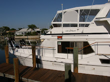
P5170038

Life’s2Short” rafted to “Allegria” in the distant background.

P5170040

With easy access to the Atlantic, Southport is home to many commercial shrimp boats.

P5170043

That evening we walked over to the Provision Company for a cold beer and some spicy steamed shrimp.

P5170039

On Tuesday we traveled 64.5 miles over and eight-hour period from Southport to Mile Hammock Bay, a basin dredged out by the military for use with Camp LeJeune. We left at 9:15 a.m. and motored about ten miles up the Cape Fear River toward Wilmington before reconnecting with the Intracoastal Waterway. As we passed through the Wrightsville Beach area we noticed a significant positive change in the water color due to numerous ocean inlets very close to the ICW.

The Captain took these pictures of the Southport basin Tuesday morning before we untied from “Allegria.”

P5180046 P5180049

We came across this interesting house between Southport and Mile Hammock Bay. Love that pink! Even their boat had a lavender hull.

P5180052

P5180054

When we arrived at Mile Hammock Bay there were already at least ten boats in the anchorage and several more joined us within a few hours. We also saw a few military helicopters conducting maneuvers and heard a lot of exploding munitions throughout the course of the evening.

P5180055

P5180061

Along with four other boats we left the anchorage just before 8:00 a.m. Wednesday to catch the 8:30 opening of the Onslow Beach Swing Bridge four miles away. Just as we started up the Intracoastal, a moderate rain shower hit but it had blown through by the time we reached the bridge.

Forty miles and five hours later we reached Morehead City where we tied up to a 50-foot floating dock in front of the Ruddy Duck Tavern. We left “Life’s2Short” around 2:00 p.m. and spent a few hours walking around downtown Morehead City, including a visit to the Carteret County Chamber of Commerce to gather local information. Later we enjoyed a very nice dinner at the Ruddy Duck.

P5230001

P5190064 P5190063

We left the Ruddy Duck dock Thursday about 10:00 a.m. and headed out the Beaufort Inlet to an anchorage about seven miles offshore that Todd found on Active Captain and was very excited to try. It is called Cape Lookout Bight and is the home of the Cape Lookout lighthouse. The anchorage is a big basin next to the Shackleford Banks at the extreme south end of the South Core Banks, part of North Carolina’s Outer Banks.

The basin is mostly surrounded by sand dunes and is very beautiful; its downfall is a 25-foot anchoring depth with dubious holding. Contrary to the many “excellent” and “good” anchor ratings we reviewed on Active Captain, we made three attempts to get a decent hold, even getting out our Danforth and giving it a shot, but nothing wanted to hold in the soft mud. We finally ended up using our CQR (our main anchor) and putting out 125 feet of chain, keeping our fingers crossed that we wouldn’t have any unsettled weather during our stay.

Leaving Morehead City, bound for Cape Lookout.

P5200065

Late Thursday afternoon we dinghied to the beach rimming the basin and walked over the dunes to the beach on the Atlantic where we spent a few hours shelling and enjoying the beauty and power of the ocean.

Anchored in Cape Lookout Bight.

P5200074

“Our” beach on the Atlantic side.

P5200067

While I was preparing dinner that evening the Captain went back over to the Atlantic side and took several sunset photos from our earlier vantage point.

P5200077

P5200078

P5200086

P5200099

P5200105

Early Friday morning Todd took off in the dinghy hoping to catch some fresh fish for dinner but returned a few hours later, disappointed and empty-handed.

These dog sharks seemed very interested in Todd’s dinghy when he was out fishing.

P5210121

We then dinghied across the basin to explore the area around the lighthouse. The Cape Lookout lighthouse is unique in that its checkered pattern provides direction. The black diamonds point north and south while the white diamonds point east and west. The 163-foot lighthouse is currently undergoing maintenance and is off-limits to visitors, but it is expected to reopen in July. Too bad we won’t have an opportunity to climb the 201 spiral iron steps to the top!

P5210122

P5210129

Another shot of the Atlantic beach south of the lighthouse.

P5210127

Friday afternoon we repeated the previous day’s trip to the beach to enjoy the nice weather and the sounds of the ocean.

After two calm nights at anchor, we decided to head back to Morehead City Saturday morning. We pulled in to the Morehead City Docks, ran a few errands and decided we would walk over the bridge to Beaufort. Just before the bridge we spotted the Morehead City Yacht Basin which is where our friends Rick & Lynnie keep their boat “Rickshaw.” We met Rick & Lynnie in the Exumas last year and hadn’t seen them since they returned to the states.

Todd had spoken with Rick earlier in the week and knew that he and Lynnie were planning to be on the boat over the weekend getting it stocked and ready to go cruising. So we decided to stop in and say hello. Lynnie hadn’t arrived yet but Rick was there and he offered to drive us over to Beaufort where we had lunch at Finz and walked around for a few hours browsing through some of the gift shops and the Maritime Museum.

P5220132

The Beaufort waterfront.

P5220131

This is the Watercraft Center, which is part of the Maritime Museum.

P5220134

When we were ready to go back to Morehead City, Rick graciously picked us up and took us back to “Life’s2Short.” Along the way we made plans to get together for dinner at the Ruddy Duck. In the meantime, Bill & Anna aboard “Knot Tide Down” were just arriving in Morehead City and ended up tying up with us at the City Docks. They also joined us for dinner where everyone had a great time. Thanks for everything, Rick & Lynnie! It was wonderful seeing you again and we look forward to crossing paths in the Chesapeake.

The Morehead City Docks with “Knot Tide Down.”

P5220136

At the Ruddy Duck with Rick & Lynnie (left) and Bill & Anna (right).

P5220137

After a late Saturday night, we pulled away from the Morehead City Docks at 9:00 Sunday morning, traveled 20 miles up the ICW and then and another 23 miles up the Neuse River to the town of New Bern. We anchored in the bay near the Galley Stores Marina around 3:00 p.m. and were joined by “Knot Tide Down” an hour-and-a-half later. About 6:00 p.m. a storm rolled through depositing quite a lot of rain and producing some heavy-duty lightning and thunder but limited wind, which was good since we were in an exposed anchorage.

Today is Monday, May 24th, and more storms are currently moving in from the east. We have taken a slip at the Galley Stores Marina to wait out a tropical depression that is scheduled to hit the coast within the next few days. While here we will do some re-provisioning and see what the town of New Bern has to offer. Once the weather settles down again, we will boat across Pamlico Sound to the Outer Banks to visit Ocracoke. After that we will continue north through Pamlico Sound to Manteo and then on to Albemarle Sound to check out various points of interest. “Knot Tide Down” is planning to join us for at least part of it and it should be a fun trip!

Sunday, May 16, 2010

From Florida through Georgia and South Carolina

On Monday, May 3rd, we traveled 40 miles from Alligator Creek (in Florida) to Jekyll Island (in Georgia) with a 45-minute stop in Fernandina Beach to refuel.

We saw Jacksonville Bob’s brother’s shrimp boat, “Island Girl,” as we were passing through Fernandina.

P5030002

The tide started going out just as we reached St. Andrew Sound, and the east wind rapidly made for rough going in the open water with an outgoing tide. After three attempts we finally got anchored at Jekyll Island in an area on the west side of the ICW indicating four feet on the charts. But it ended up being a good anchoring depth with solid holding.

The S. S. Sophia cruising north past our anchorage. Nice boat!

P5030005

That afternoon the Captain did some fuel calculations and we determined that we have traveled more than 14,000 miles aboard “Life’s2Short” in the past four years. That is the equivalent of five one-way trips across the United States from Charleston, South Carolina to San Francisco, California!

Tuesday morning we dinghied over to the free public dock and walked to the ocean on Jekyll Island, about one-and-a-half miles. We then caught a ride back with a very nice man who is a sanitation worker on the island and who just happened to be heading our way.

Our Good Samaritan Joe. Thanks for the lift!

P5040006

We left just before noon and covered 32 miles to anchor in Back River by 4:00 p.m. We barely had time to get the hook dropped and the snubber on when big wind and rain hammered us! Greg & Susan aboard “Allegria” ran offshore that day and were just coming in from the Atlantic through Doboy Sound when the storm hit. They made it through without incident, though, and ended up anchoring in the Duplin River. After a few hours the rain passed and it was a comfortably cool, calm evening.

The encroaching storm.

P5040007 P5040008

A gorgeous sunset after the storm.

P5040009

Wednesday was a beautiful morning. We took off for Blackbeard Island about 10:00 a.m. to reach the creek entrance a couple of hours before high tide. “Allegria” met us in Sapello Sound and followed us through Blackbeard Creek to the anchorage. “Allegria” drafts five feet and there were a couple of shallow areas where she kissed the bottom, but both boats made it through just fine.

Allegria” meets mini cruise ship “American Glory” on a tight bend along the ICW.

P5050014

Allegria” winds through Blackbeard Creek.

P5050016

After we got anchored we put the dinghy down and Todd ferried Greg & Susan over to the island to walk the beach. He then picked me up and we dinghied about a mile down to the point to meet them. As Greg & Susan said, being on Blackbeard is like having your own private island since few people venture in here.

Anchored at Blackbeard.

P5050018

P5050023

Todd befriended this Canadian goose that couldn’t get enough bread! His mate is apparently sitting on a nest somewhere in the vicinity.

P5050024

Greg & Susan invited us to join them for dinner and we spent a very pleasant evening aboard “Allegria.” Thanks for the hospitality, guys!

P5050027

Thursday morning started out foggy and cloudy but cleared off by afternoon. “Allegria” headed out about 1:15 p.m. and radioed to let us know that they had safely navigated through the creek by 2:30. Todd spent several hours during the morning and early afternoon fishing but was only able to produce one flounder for his efforts.

By Friday the temperatures were rapidly approaching the 90’s. We decided to put a few more miles behind us but weren’t able to leave the anchorage until around 2:00 p.m. because of the tide.

Late Friday morning at Blackbeard waiting for the tide to rise.

P5070029

P5070028

We traveled 35 miles Friday afternoon to Queen Bess Creek and were anchored by 6:30 p.m.

P5070002

Saturday we were up by 6:45 a.m. and underway within a half hour. The tide was falling all morning and we needed to catch as much of it as possible to get through some shallow/shoaling areas before low tide. We motored through the Savannah area just before low tide and, 41 miles later, were anchored at Bull Creek (South Carolina) by 1:00 p.m., where we spent a very warm and windy afternoon.

With 30 miles to go to reach Beaufort, we headed out shortly after 8:00 a.m. Sunday (Mother’s Day) and arrived at the Downtown Marina very close to slack tide, which was the goal. The temperatures had cooled down considerably overnight but the wind was still blowing, causing both Calibogue and Port Royal Sounds to be a bit on the choppy side.

Even though we spent time on mooring balls in both Marathon and Key West and at a few private docks over the past several weeks, this is the first marina we’ve been in since leaving Bonita Bill’s on March 24th!

P5090005

After a very quick run to Wal-Mart using the marina’s courtesy car (one-hour limit), we got cleaned up and walked in to town for the evening. After much anticipation the Captain had his beloved shrimp & grits at Panini’s but neither of us believe the recipe is the same as when he originally ordered it in September of 2008. Nonetheless, the food was good and we had a fun evening exploring Beaufort’s waterfront again.

The mini cruise ship “American Star” was docked in Beaufort when we were there. We met its sister ship “American Glory” along the ICW a few days ago (photo above).

P5090008

P5090006

Monday morning I tackled laundry while the Captain changed the oil in both engines and the generator. We pulled away from the marina at 11:30 a.m. with 40 miles to put behind us. Along the way the Captain attracted a number of sea gulls looking for a handout and he was happy to oblige!

P5100041

After another cool, breezy day fighting current most of the way, we were secure in our Tom Point Creek anchorage by 5:00 p.m., accompanied by several of the Captain’s pet sea gulls!

This is one of our favorite South Carolina anchorages.

P5100045

At high tide, the creek overflows into the surrounding grasslands.

P5100043

It took us over four hours to motor the final 30 miles to the Charleston Maritime Center on Tuesday where the Captain backed in to a slip for the first time – and did a fine job of it! Actually, he did back in to a slip one other time, on the Black Warrior River in the fall of 2006, but the slip was probably 30 feet wide and he was just practicing. So I consider this his first “real” backing effort.

P5130086

When we were at Blackbeard Island last week, Todd dove the boat to check the transom zincs and discovered that we had a coating of small barnacles on the hull. So he arranged for a couple of divers to scrape our bottom at the Maritime Center. After they were finished we headed in to town to meet up with Greg & Susan on “Allegria” who had arrived the previous day and were staying at a local yacht club.

After a couple of drinks at the rooftop bar of the Market Pavilion Hotel, we walked through part of the City Market as the vendors were packing up for the evening. We then said our goodbyes to Greg & Susan who went off in search of dinner. We wandered around for a couple more hours before stuffing ourselves on Caroline Sweet ribs at Sticky Fingers.

This is the bar on the main floor of the Market Pavilion Hotel, a very classy place!

P5120063

The Captain washed the salt off the boat Wednesday morning and then we walked in to town to find some lunch. After a quick sandwich at Five Guys Burgers and Fries, we took our time meandering around town and through the City Market.

Charleston has a number of steepled churches in its downtown area.

P5120048 P5120081

The next three photos are part of the College of Charleston which has a beautiful campus.

P5120051 P5120052

P5120053

Although it’s difficult to ascertain from the photo, this corner house has an angular slant to it, similar to a triangle.

P5120054

The Captain couldn’t pass this by without taking a photo!

P5120055

Different ways to tour Charleston.

P5120056

P5120058

The Charleston City Market.

P5120059

P5120061

After we finished at the City Market, we stopped in at The Blind Tiger Pub for a cold beverage in its unique, historic courtyard bar.

P5120076 P5120065 P5120071 P5120073 P5120075

Charleston has many beautiful, historic buildings.

P5120083 P5120082

This street was made from stones used as ballast in ships. When the ships reached Charleston, they dumped the stones and filled the empty space with cargo to take back home.

P5120078

Later that evening we enjoyed a lovely meal on the patio of the Cru Cafe, a small locally popular restaurant situated in an old house on Pinckney Street. If it hadn’t been recommended to us by a local, we wouldn’t have known it was there!

P5120084

After a quick trip to Harris Teeter late Thursday morning to get some fresh produce, we said goodbye to Charleston at 11:30 a.m. and made our way another 50 miles up the ICW to Minim Creek where we were anchored by 6:00 p.m. Unfortunately, the green flies and mosquitoes joined us there as well!

We saw this bald eagle on the way to Minim Creek.

P5130087

The Admiral chases green flies off the flybridge.

P5130088

We were off before 9:00 Friday morning to catch the current of the rising tide through Georgetown and on to Thoroughfare Creek, about 26 miles. We were anchored by noon and spent a quiet afternoon relaxing on the boat.

Entering Thoroughfare Creek, another of our favorite anchorages.

P5140089

P5140092

Sandy Island John, who we met here in October of 2008, boated by with his friend Ricky about 5:00 p.m. and invited us over to his house on a nearby canal system. After grabbing a quick bite to eat, we dinghied over and spent a few hours socializing and enjoying the view from John’s porch.

P5150019

Sandy Island John.

P5150020

Saturday was another beautiful, sunny day. John picked us up that afternoon and took us for a boat ride up Thoroughfare Creek to the junction of the Great Pee Dee River which runs north from Georgetown where we saw a few of the old rice plantations that border the river.

A busy Saturday on the sandy beach.

P5150001

Off on a boat ride with John and his faithful companion Hap.

P5150013

An old rice plantation with a gorgeous home and landscape.

P5150005

Other remnants of rice plantations along the Great Pee Dee River.

P5150002 P5150008 P5150010

P5150014

John dropped us off at “Life’s2Short” on the return trip so we could pick up a few items and then we dinghied over to John’s again. That evening he fixed his “Sandy Island Special” consisting of chicken that he first boils, then grills; baked sweet potatoes with butter and brown sugar, rice cooked in the chicken juices and John’s famous homemade cole slaw. What a treat!

Ricky and Todd feed Ricky’s baby blue jay that he found abandoned a few weeks ago.

P5150015

John prepares his “Sandy Island Special” for us.

P5150017

Before dinner we took a quick boat ride with Ricky to pick up John’s neighbor whose boat was “high & dry” at a nearby landing.

P5150022

Today is Sunday, May 16th, and we are putting the final 50 miles of South Carolina behind us. After about the first 15 miles today, where the Waccamaw River splits off and runs up to Conway, everything will be virgin territory. By tomorrow we will be in North Carolina looking for new adventures in uncharted (for us) territory!

We found this little guy on the flybridge this morning as we were preparing to leave Thoroughfare Creek.

P5160028